The Unama’ki Institute of Natural Resources, in cooperation with the Eskasoni Fish & Wildlife Commission, has created an information map for each of the Unama’ki First Nation communities. Using Geographic Information System (GIS), these maps are a valuable resource for long-term monitoring and community planning. The maps contain information on drinking water monitoring sample sites, infrastructure, and land contours in a format that can be easily understood by community members. The maps are available in the band office in each community. or you can see a copy at the UINR office in Eskasoni.
Special thanks goes to Jason Pierro and Angela Morris for data collection and map development; Brian Morrison and Len O’Neill, Health Canada First Nations & Inuit Health Branch Atlantic Region for their comments; and the community members in each of the Unama’ki First Nations for their assistance.
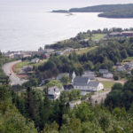
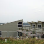
Photographs of our five Unama’ki communities that were taken for this publication by UINR’s Director of Communications, Weldon Bona.
Funding for this project was provided by Health Canada First Nations & Inuit Health Branch Atlantic Region.
info@uinr.ca
From UINR Marten – Vol.3. Issue.1 – Spring 2007